

Keep Brandt River Bottom Accessible

Before the Commissioners Court meeting last Thursday, Jeff Wick and I held our usual meeting to review the meeting agenda to see what items might interest our readers. Towards the end of the agenda, I saw an item that interested me:
“Discuss and approve putting a gate up at the end of Brandt River Bottom Rd. in Precinct #4.”
“Oh no!” I screamed to Jeff.
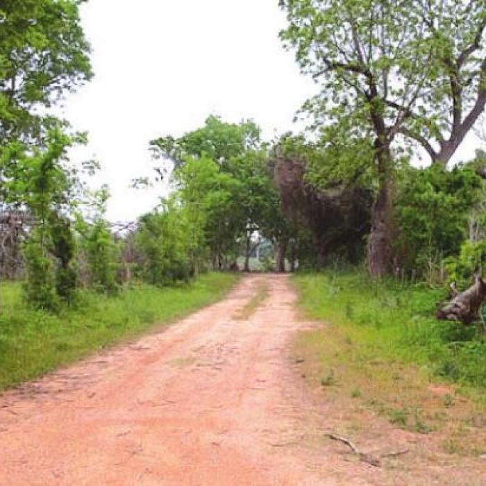
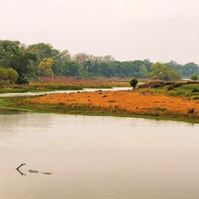
Many locals, including myself, abbreviate the spot and refer to it as “Brandt Bottom.” The road runs from FM 155 near Holman to the bank of the Colorado River. The road literally dead-ends into the river. I’ve been fishing and exploring the river from this spot for about 20 years.
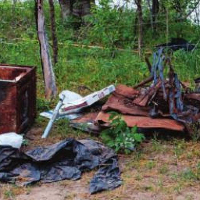
I knew right away why the County wanted to put a gate across the road. Every time I go down there I find piles of trash. Sometimes there are strange-looking folks down there who appear to be more interested in using hard drugs than fishing or swimming. Several times during these encounters, my fishing companions and I have dealt with the situation by loading up the trash in front of these strange folks, which usually shames them into leaving. Then we can fish in peace.
I lamented to Jeff about the public possibly losing access to this great river spot. He suggested that I speak my mind during the public comment period at the meeting, so I did.
I told the Commissioners that Brandt River Bottom Road provides the public with access to this very special section of the river, far away from town, and that I didn’t think it was right for the County to suddenly take that away. They graciously listened and invited me to participate in the conversation when they got to that agenda item.
When they took up the item later in the meeting, I learned the problem was far worse than I thought. Pct. 4 Commissioner Drew Brossmann said the Sheriff’s Office recently received complaints from neighbors across the river about people shooting guns at night. Brossmann said the shooters may have used a building across the river as target practice, because the neighbors found bullet holes in the wall. Moreover, he said, the place looks as though some people have been using the end of the road as a homeless camp of sorts.
I haven’t been to Brandt Bottom since last year, so I drove down there Monday morning and saw it for myself. At some time, these troublemakers built a large trash fire and burned down a cornerpost at the end of the road. Cow manure on the road indicated that the neighbors cattle were getting out. That wasn’t the only manure I found. Some distinguished human decided to defecate in a burned-up microwave that was standing on its back.
At the meeting, before my visit, Brossmann said he felt that he had to act after the shooting incident.
“I would just feel horrible if someone got shot across the river because I didn’t do anything about it,” he later told me.
I agree with Commissioner Brossmann. The County does need to keep these miscreants from ruining a great beautiful spot on the river. However, I think closing access to everyone is going too far.
At the meeting, Brossmann presented a map from the Fayette County Tax Appraisal District that indicates the County property ends a few hundred feet from the bank, near the last private driveway. Past that point, the map indicates that the two property owners on either side of the road share a property line down the middle of the road. Brossmann proposed putting up a gate at the spot where County property ends according to that map.
Commissioners ultimately decided at the meeting to study the matter and find out where exactly the County’s property ends. They also decided to put up some signs saying “County Maintenance Ends,” “No Dumping” and “Authorized Personnel Only.” Pct. 3 Commissioner Harvey Berckenhoff remarked that the signs would just give the troublemakers another target to shoot at.
I told the Commissioners that I understood their position but regretted that it had to come to this. After the meeting, I gave it some more thought.
Even if the property past the spot on that map is private, the public has been treating it as de facto public property for decades at least. I found a pull-tab from an old beer down there Monday morning to prove it. They haven’t made beer cans with pull tabs since the 1980s.
I propose a couple of possible alternatives.
First, I think the Sheriff’s Office could help by sending deputies to patrol the area every few days and on the weekends. I know it’s a long way from Schulenburg or La Grange, but I think the county residents who live in between would appreciate the extra patrols. Maybe the deputies could catch these troublemakers breaking the law or at least coax them into leaving.
Second, if the County does put up a gate, I think it should be unlocked from dawn until dusk. That way, the public could still access the river. I’ve gone on some pretty epic fishing trips at night from that spot, so it isn’t an ideal solution for me, but I could live with it. There’s a legendary fishing spot on Garcitas Creek in Jackson County with similar access. Jackson County keeps a gate locked at night across the road that leads there.
I’m sure everyone who has ever explored the Colorado from Brandt Bottom can tell a few stories. Here are a couple of mine.
One time, my brother-in-law and I rode in my flat bottom boat all the way from Brandt Bottom to La Grange. We put in too late and stayed out there too long. The sun was going down. Our trucks were back at Brandt Bottom. Joe found a little flashlight in his tackle box. I think we stole the batteries out of the bait bubbler to make it shine. He stood at the bow shining the light and giving me directions. This was before the river had any cell phone coverage. The lower unit hit gravel many times. I replaced the impeller the next day. Our wives, knowing our ways and the lay of the river, got worried and went down to Brandt Bottom. They shined headlights in the water to guide our way. We would have ended up in Columbus without those lights.
Another time, again with Joe, we put the boat in at Brandt Bottom and went upriver. This was before the Hurricane Harvey flood, and the river bottom was much more wooded closer to the bank back then. We traveled some distance to an island. The main channel flows on the right side of this island when you face downstream, and a narrow channel flows on the left. The recent floods, I believe, have deepened that narrow channel. Back then, it was shallow and kind of muddy. We found a Charolais heifer, which looked to be bred, stuck in the mud in that spot. We tried prodding her out with my push pole, but she wouldn’t budge. Joe kind of harnessed her with the anchor rope and I tried pulling her with the boat. My old 15 hp Johnson couldn’t budge her, either. Neither of us could get cell phone service down in the river bottom, so we climbed up the high bank and found some reception. I called the Sheriff’s Office, gave the location as best I could, and told them what we found. We fished around the area all day and checked on her from time to time. No one came. Near the end of the day, on the way back to Brandt Bottom, we stopped and prodded her again. No luck. Joe carried a pistol, partly for the river critters with sharp teeth, but also on account of the strange folks that sometimes show up at Brandt Bottom. We thought about putting her down. I wonder what ever happened to that heifer.
According to the Texas Historical Commission, Gen. Sam Houston and his Texian Army crossed the Colorado River at Burnham’s Ferry back in 1836 on their run march east, which ended in victory at San Jacinto. Diligent work by the Fayette County Historical Commission and other historians culminated a few years ago in the transfer of the Burnham’s Ferry historical marker from a location on the River near the Fayette-Colorado county line to the top of a hill in Holman just off FM 609, closer to the presumed location.
I’d bet the true spot lies no farther than the distance a kingfisher flies from the end of Brandt River Bottom Road.
The River’s course likely changed a bit since the days of that march. I’d also bet those hundreds of soldiers and perhaps many more families on the Runaway Scrape left behind some evidence - lead shot, buttons, buckles and the like.
It could be a great project for one of Texas’ fine institutions of higher education - an archeological dig. Perhaps the surrounding landowners graduated from Texas A&M, University of Texas, SWT, Tech, U. of H. or Rice. Maybe they would give their alma mater permission to comb their property.
The work should be done, for posterity’s sake.
But for right now, I’d hate for local folks to lose this access spot on the River. I hope the County can find some way to keep it open.